As of 20 Oct 2026, 18:25 (UTC+7) / 12:25 UK time (BST)
The Met Office has named Storm Austen, warning of disruptive wind and rain for parts of the UK from late Thursday 22 October into Friday 23 October 2026. A yellow warning for wind covers southern parts of England and south Wales from 00:00 to 12:00 BST on Friday, with a chance of travel disruption and power cuts. Here is what travellers need to know.
Travelling in the UK when storms disrupt trains, roads and flights? Platform changes, cancellations and rebooking links mostly arrive by app, text or email. With your own mobile data you can check journey status, rebook and use maps without relying on station or hotel Wi-Fi. Follow the Met Office and your operator first.
At a glance
| What | Details | Source |
|---|---|---|
| Storm | Storm Austen, named by the Met Office at 10:45 BST on Tue 20 Oct | Met Office |
| When | Late Thu 22 Oct into Fri 23 Oct; winds generally easing later on Friday | Met Office |
| Warning | Yellow wind warning, 00:00–12:00 BST Fri 23 Oct (06:00–18:00 UTC+7) | Met Office warnings |
| Where | Southern parts of England and south Wales | Met Office warnings |
| Wind | Gusts of 50–60 mph likely more widely; over 70 mph possible on the most exposed coasts | Met Office |
| Travel | Small chance of longer journey times or cancellations on road, rail, air and ferry services | Met Office warning text |
What the Met Office says
In a statement issued at 10:45 BST on 20 October, the Met Office said Storm Austen will bring disruptive wind and rain for some from late Thursday and into Friday, with the focus on the south-west of the UK as the storm approaches.
Deputy Chief Forecaster Tom Crabtree said gusts of 50–60 mph are likely more widely within the warning area, and peak gusts in excess of 70 mph are possible on the most exposed coasts. He added that warnings are under constant review and could be updated as confidence increases.
Rain is an extra hazard, with 20–30 mm in many places. Storm Austen should move west to east through Friday, with winds easing later in the day, but further spells of wind and rain are likely through the weekend and into next week.
Where the yellow warning applies
The Met Office yellow wind warning runs from 00:00 to 12:00 BST on Friday 23 October (06:00 to 18:00 UTC+7). The areas listed include South West England (such as Cornwall, Devon, Dorset, Somerset and Bristol), Hampshire, the Isle of Wight, East and West Sussex, and south Wales (such as Cardiff, Swansea, Newport and Pembrokeshire). Check the map for your exact town: the Met Office says it is still uncertain where the strongest winds will be.
The warning text says there is a small chance of longer journey times or cancellations as road, rail, air and ferry services are affected, a small chance that some roads and bridges could close, and a slight chance of power cuts that could affect other services, such as mobile phone coverage.
Who is affected
- Rail travellers in South West England, along the south coast of England and in south Wales on Friday morning.
- Air travellers using airports in the warning area, or flying to or from them, on Friday.
- Ferry passengers on routes from south-west and southern England and from south Wales.
- Visitors on the coast, where large waves can be dangerous even from the shore.
What to do now
- Check your journey the evening before and again on Friday morning. Use National Rail Enquiries for trains, National Highways for roads in England, and your airline or ferry operator for flights and sailings.
- Move non-essential trips out of Friday morning if your ticket allows it.
- Leave extra time for airport and station transfers.
- Stay back from the sea front, sea walls and cliff paths during the storm.
- Charge your phone and a power bank on Thursday evening, and download offline maps in case of power cuts.
- Follow the Met Office: the warning could change before Friday. See its advice on travelling in storms.
- Keep mobile data on during your journey, so rail, road and airline updates reach you on the way. Choose a UK eSIM plan
Staying connected during the storm
On disrupted days, platform changes and rebooking links often arrive by app, text or email. If you are visiting the UK, a UK eSIM lets you set up mobile data before you fly, so you are not relying on station or hotel Wi-Fi. If your trip also takes in mainland Europe, our EU + UK eSIM may suit you better. Always follow official instructions first.
For other disruptions this week, see our weekly travel disruptions roundup and our guide to the Spain and France rail strikes.
Official sources
- Met Office: Storm Austen named (20 October 2026)
- Met Office UK weather warnings
- Met Office UK Storm Centre
- National Rail: status and disruptions
- National Highways: travel updates
FAQ
When does Storm Austen hit the UK?
The Met Office expects disruptive wind and rain from late Thursday 22 October into Friday 23 October 2026. Its yellow wind warning runs from 00:00 to 12:00 BST on Friday 23 October (06:00 to 18:00 UTC+7).
Which areas are covered by the Storm Austen warning?
The yellow wind warning covers southern parts of England and south Wales, including South West England, Hampshire, the Isle of Wight, Sussex and south Wales. Check the Met Office warnings map for your exact location.
Will trains, flights and ferries be cancelled?
The Met Office says there is a small chance of longer journey times or cancellations as road, rail, air and ferry services are affected. Check with your rail company, airline or ferry operator before you leave.
How strong will the winds be?
The Met Office says gusts of 50 to 60 mph are likely more widely within the warning area, and gusts in excess of 70 mph are possible on the most exposed coasts.
This article is for travel planning only and is not official guidance. Always follow the Met Office and instructions from local authorities and transport operators.
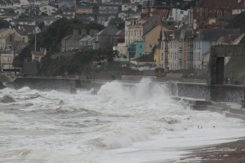
Photo: waves break over the sea wall at Dawlish, Devon, as a train passes during a storm (file photo, resized). Geof Sheppard / Wikimedia Commons, CC BY-SA 4.0
 United Kingdom eSim