Answer-First Summary
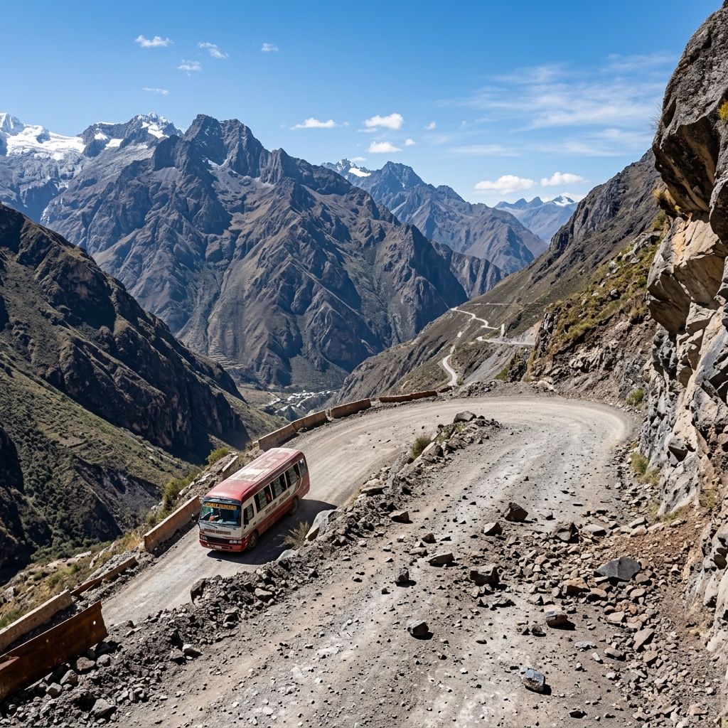
A series of earthquakes in the Junín region of the central Andes has caused building collapses and rockfall hazards on mountain passes in Peru as of July 19, 2026. Travelers heading east from Lima are urged to check road clearance status on National Route 22, postpone non-essential treks, and carry backup mobile data for emergency routing.
Key Takeaways
- Current Status: Seismic activity and active debris clearances in Junín region (Chupaca Province) as of July 19, 2026.
- Transit Impact: Central highway sectors are subject to brief closures due to landslide risk checks.
- Safety Measures: Avoid parking near steep cliff edges; stay updated via INDECI (civil defense) alerts.
- Emergency Contact: Dial 105 (Police) or 116 (Fire & Rescue) in Peru.
- Connectivity Tip: Mountain valley signals can be weak; carry a backup Peru eSIM for offline map coordinates.
Phase 1: Airport Arrivals and Flight Advisory
Travelers arriving in Peru via Jorge Chávez International Airport (LIM) in Lima should monitor updates if scheduling onward journeys to the central Andes. While flight operations at the airport remain normal, overland transit eastward faces interruptions due to rocky debris clearances. Verify vehicle transfer plans before departing the terminal.
Establish your local mobile connection before leaving the airport, as accessing real-time geographical data is critical when traveling through mountainous terrains. For detail on the geography, see the Junín Region on Wikipedia.
Phase 2: Transiting Safely Through City Commutes
Local commutes in central Andean towns within the Junín region may be restricted due to damaged structures. Civil defense forces are clearing debris from streets. If you are driving, check road statuses. Avoid parking under old stone walls or buildings made of traditional adobe materials.
Cooperate with municipal traffic wardens managing detours around active rescue zones.
Phase 3: Postponing Regional Excursions and Road Warnings
Trekking and mountain excursions in the Chupaca Province should be postponed until geological safety assessments are complete. The national disaster response agency (INDECI) warns that aftershocks can trigger secondary landslides on steep mountain passes. Keep headlights active if driving through dusty passes.
Always verify road accessibility updates with the transport authority (SUTRAN) before using the Central Highway.
Phase 4: Savoring Local Food and Dining Tipping While Sheltering
If you are staying in local hotels, dining in the hotel restaurant is the safest option. While tipping is not mandatory in Peru, leaving a tip of 10% for waitstaff in restaurants is standard and highly appreciated. It helps support the local community during emergency periods.
Most tourist businesses accept card payments, but keep some cash (Peruvian Sol) with you, as regional power cuts can disable electronic terminals.
Current Safety & Transit Status
| Location / Transit Hub | Current Advisory Status | Action Required for Travelers |
|---|---|---|
| 📶 TravelyData eSIM | Active Emergency Backup | Verify roaming is active; select Claro or Movistar for high altitude coverage |
| 📶 Central Highway (Route 22) | Active debris clearances; partial closures | Check SUTRAN live alerts before starting road trips |
| 📶 Chupaca Mountain Trails | Closed due to aftershock landslide risks | Postpone all trekking excursions in the province |
Frequently Asked Questions
Q1: Are tourist trips to Machu Picchu affected by the Junín earthquake?
A1: No. Machu Picchu is located in the Cusco region, far south of the earthquake epicenter. However, verify local weather and train schedules before departure.
Q2: How do I contact emergency services in Peru if I need help?
A2: You can call the national police emergency line by dialing 105, or dial 116 for the fire department.
Q3: Will local buses and regional trains run during the aftershocks?
A3: Buses along the Central Highway are running with delays. Check with the bus terminal desk for schedule modifications.
 Peru eSim